What type of video, images and media are you using in your classroom? I’ve shared lots of favorites when visiting schools and presenting at events this year. One of the resources I love to highlight is an awesome website from Google Arts and Culture. There are so many fantastic resources on this site to dive into but I absolutely love the Google street views for your classroom!
There are over three thousand Google street view experiences to choose from on this special section of their website. It’s pretty easy to navigate by using the search bar at the top of the screen. All you have to do is type in a keyword then look through the resources that appear after your search. Just scroll down to where “museum views” pop up to view the Google street view experiences. You’ll find that many of these resources include links to extra information to incorporate into a lesson too.
When would you use Google Street Views with students?
Sometimes there is just no way to take students to a specific place you’d like them to explore. Although there isn’t a substitution for the “real thing,” these resources from Google help transport students to new places to help them learn about the world and the lives of people in different places.
You might use Google street views with students to help them imagine the setting of a book or think about how a character interacts with the world during a novel study. In the science classroom you might ask students to compare two different ecosystems as they learn about animal habitats, and so much more.
Download my virtual reality eBook with more tips for teachers.
Google Street Views for Your Classroom
Although there are thousands of Google street views to search through I thought I’d pick out a few favorites in case you’re in need of inspiration. On this list I’ve highlighted several favorites along with ideas for how each one might connect to the learning goals for your next unit of study. Remember to place tasks before apps and choose a virtual experience that connects to your learning goals.
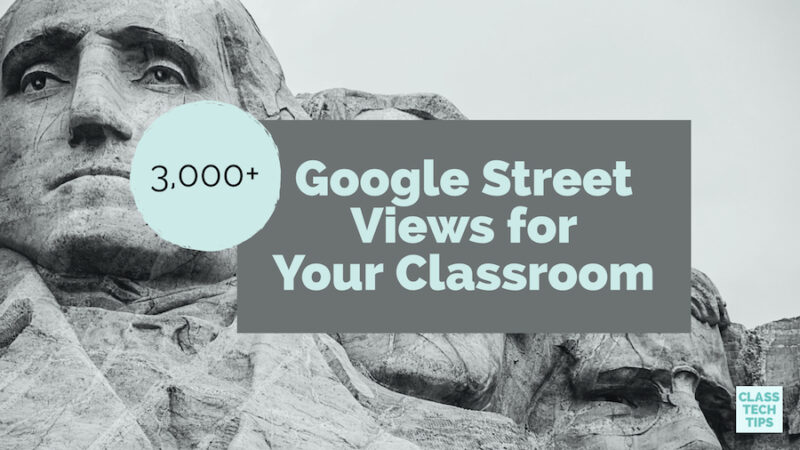
Mount Rushmore
This street view lets students look up at Mount Rushmore and gain a better understanding of its placement in the middle of a forest. You might introduce this to your students when discussing scale in the math classroom or before reading a biography of Theodore Roosevelt or George Washington. This might also be a street view you introduce as students get ready to study national landmarks.
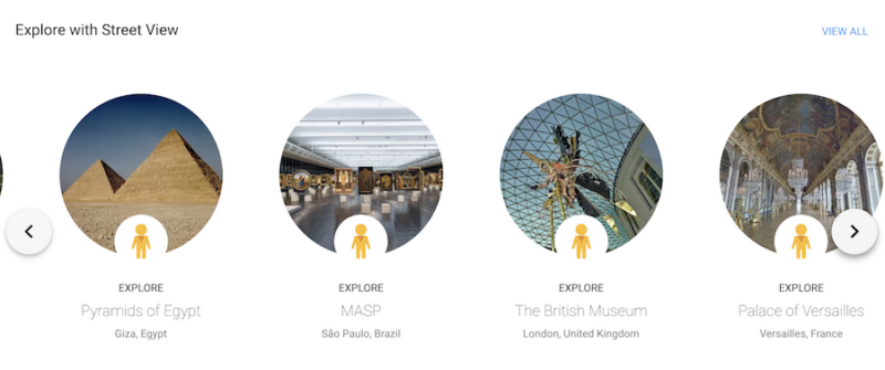
Palace of Versailles
With this street view students can tap on the screen to walk through the Palace of Versailles. As they move through the halls they can look up, down and all around. This resource also includes links to different rooms in the Palace making it pretty easy to navigate around. If you can’t take your students on a trip to Paris this year, you might use this Google street view during a discussion on the French Revolution, art history, or architecture.
Machu Picchu
Want to take your students on a walking tour of Machu Picchu but can’t fit a trip to Peru on your schedule? This Google street view is perfect for classrooms where you’re diving into different cultures, exploring the geography of South America, or making cross-curricular connections with informational text or literature around this topic.
Ford’s Theater
If you’re studying American History with your students you may want to check out this Google street view that transports students to Ford’s Theater. They can stand on the stage and learn about the assassination of Abraham Lincoln as they click on some of the extra resources on the bottom of the screen.
Taj Mahal
The Google street view for the Taj Mahal is very impressive. Students can walk towards this iconic landmark and look around in every direction. You might introduce this resource to students when exploring geometric shapes in the math classroom or looking to bring a social studies lesson to life.
Statue of Liberty
As a typical native New Yorker, the only time I’ve been to the Statue of Liberty is when relatives were visiting from out of town. Although I had the chance to take students to many New York City landmarks as a classroom teacher, I love this particular Google street view because it lets anyone stand on the ground in front of the Statue of Liberty. Students can look out up at this famous landmark or turn to view the New York City skyline.
When you’re looking for a specific street view to share with students use the search bar at the top of this screen and scroll down to see if there are any “museum views” related to your keyword search. Remember, just like any super cool online resource you want to make sure you put the learning first and focus on your objectives. This is the topic of my book Tasks Before Apps: Designing Rigorous Learning in a Tech-Rich Classroom, where I share strategies for creating meaningful learning experiences with technology. Grab my free Tasks Before Apps poster by clicking here.
Do you have a favorite Google street view to share with students? Add it in the comments below!